![]()
Just going through the motions when you plan a flight could imperil you and your passengers should something unexpected happen. Proper preparation will minimise the risks posed by your flight going awry.
Personal minimums
A pilot serious about good flight planning will begin by asking themselves, ‘do I have the skills to safely make this particular flight on this particular day in this particular aircraft?’
Your personal minimums should be higher – or more restrictive – than the legal minimums, and set on the day of the flight, taking into account your currency, competency, and the conditions on that day.
Included in that assessment of your ability to safely fly that day, you need to be brutally honest about your own well-being: your level of fatigue, or degree of stress, for instance.
Those personal minimums should not be ‘amended’ during the flight to suit your desire to get to your destination, or the demands of your passengers.
Take the time, be methodical
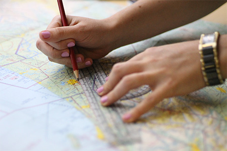
Photo courtesy of Aeropath
If your answer is ‘yes’ to the question ‘is this flight within my capabilities as a pilot?’ you next need to spend enough time to do your homework properly.
Rule 91.217 Preflight action says a pilot-in-command must collect and understand all available information relevant to that flight.
That information includes:
- Current meteorological information
- Fuel requirements and considerations
- Alternate aerodromes available
- NOTAMS and AIP Supplements
- Aerodrome conditions
- Aircraft performance data.
South Canterbury Aero Club CFI Aaron Pearce always starts with the weather.
“Can I even depart? What are the enroute conditions? What are they like at my destination? There’s no point going on to plan a flight if the weather isn’t playing ball.
“I next go to NOTAMS and AIP Supplements. Can I get into the aerodrome I want to get into?
“I always do my flight plan checks in the same order. That way I don’t forget anything.”
Selecting a route

Photo courtesy of Aeropath
There are several things to take into account when you’re working out your best route using a visual navigation chart. They include minimum safe altitudes for the terrain you’re flying over, aerodromes you’ll be flying near, airspace designation, and refuelling options.
Once you’ve decided on your optimum route, get as much relevant information as you can into a flight log, leaving your calculations until you have the most up-todate weather information.
Sharn Davies, the CFI at Marlborough Aero Club, says one of the most important aspects of flight planning is to really ‘think it through’.
“Actually sit down with your map and your charts and think about the route you’re going to fly, and any alternatives that may be required due to weather.”
Sharn says he observes people flying into the aerodrome clearly unprepared.
“They might not be sure where and how to join. They may not be familiar with any local procedures – which are noted at the bottom of the Vol 4 charts – circuit directions, and parking areas.
“If you’re heading somewhere unfamiliar, take the time in the week before to actually think about that flight,” he repeats. “Call a local about the airfield procedures.”
Andrew Sims, CFI of Wellington Aero Club, says one of his biggest tips to pilots is ‘draw on your maps’.
“For example, approximately where you think you’re going to make that radio call, or where the airspace is approaching where you need to descend.
“Nowadays a lot of pilots will whip up a plan on their iPad®. That saves you a lot of time but you’ve still got to take yourself through, step-by-step, as to what your action is,” Andrew says.
Shannon Mickleburgh is the assistant CFI at Massey University’s School of Aviation and agrees with Andrew Sims.
“You’ve got pencils – draw all over the chart. Make notes. If you’ve got an electronic app, you can draw markers to provide yourself with cues.
“As long as you’ve done the flight in your head beforehand, all you need is a subtle reminder to kick-start where you need to go from there,” Shannon says.
Plan B
Always consider at least one alternative aerodrome and plan for that as carefully as you do your favoured route.
Shannon says there’s no reason why you can’t have at least three routes planned out beforehand.
“If you’re looking, particularly, at doing cross-country flights, you could plan multiple different routes. Think about the routes that you want to do, then based on the weather forecast, you could start narrowing them down.
So ‘OK, maybe a South Island trip isn’t going to work tomorrow, maybe we should go across to New Plymouth’ or something like that.
“Obviously, the more skilled you get, the better you’ll become at planning on the day.
“But when you’re starting out, you need to take that extra time to learn where you’re going,” Shannon says.
Weather

Photo courtesy of Vaughn Davis
Begin your Met check early on the day of the flight, then track the evolving weather situation.
Obtain the most up-to-date weather information before departure and leave enough time to interpret the data.
Shannon says thinking about the weather well ahead of time can dictate how you plan.
“For example, do you really want to be going across to the East Coast in a strong norwesterly. Obviously down south, a big consideration is dealing with the wind, and flying through the valleys down there.”
Aaron Pearce says use all the resources available to you.
“Don’t use just MetFlight – there are lots of tools out there: webcams and apps that will help build on the mental weather picture MetFlight gives you.
“Call the local aero club – they’re always more than happy to pass on the advice of a current pilot weather report.
“Calling a friend who lives there and can look out the window for you is better than guessing.
“Build a big picture of what you think the weather is going to be doing.”
Check your NOTAMs and AIP Supplements
It can never be said enough. Always check current NOTAMs (www.ifis.airways.co.nz) and AIP Supplements (www.aip.net.nz), which are free.
If you’re uncertain about the contents of an airfield NOTAM, contact the aerodrome operator.
Some danger areas, military operating areas, and restricted areas are active only when advised by NOTAM – see AIP New Zealand ENR 5 for further details.
Shannon Mickleburgh says some pilots don’t think enough about altitudes and airspace in their planning.
“For example, they’re at VFR cruising altitude of 6500 feet, but they’re not giving any thought to the fact that the airspace actually steps down as they get closer to their destination aerodrome.
“Or they’re not planning a top of descent appropriate to that, or they haven’t considered that they could just do controlled VFR to get there,” Shannon says.
Staying on the radar
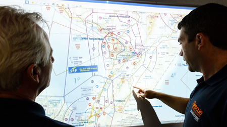
Photo courtesy of Maritime NZ.
Filing a flight plan with Airways (www.ifis.airways.co.nz) is quick, easy, and inexpensive.
If you’ve filed a flight plan, and have a forced landing, you’ve given yourself the best chance of being found.
Frances Dowdle, Manager of Air Traffic Support Services at Airways, explains how it works.
“When you file a flight plan, you’re asked to provide a SAR (search and rescue) time. If, for example, you filed your VFR flight plan and said your SARTIME was going to be 0500 UTC, if the SARTIME has not been cancelled by 0500 UTC, we’re immediately alerted that the flight is overdue.
“We then have 15 minutes to carry out a series of tests to try to locate and contact you. If we can’t raise you or confirm that the aircraft is still flying within that 15 minutes, we have to notify the Rescue Coordination Centre.”
Frances says you can update your flight plan.
“You can change your route and update your SARTIME with Christchurch Information at any stage along the route. You can also do that when you’re on the ground by ringing the National Briefing Office.”
Two final things about making it easier for everyone if your flight goes awry – the first is a tip from Frances: don’t let UTC conversion trip you up! New Zealand Daylight Time (NZDT) is 13 hours ahead of Coordinated
Universal Time (UTC).
And finally – if you’re having a family member or friend provide flight following, make sure they know what steps to take if things go badly.
Weight + fuel
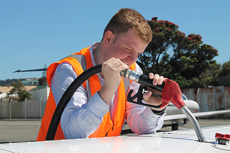
Photo courtesy of CAA/Jess Jennings
Pilots need to assess their weight and balance before they take off. Warren Sattler is the head of flight training standards at Ardmore Flying School and says pilots often don’t take enough care in assessing payload.
“I’ve lost count of the number of times newly licensed pilots arrive to take their friends for a flight with no thought to useable payload. ‘It’s a four-seater isn’t it?’ is as much as they consider.
“The CAA seat allocation is supposed to be 190 pounds. But when those people say, ‘oh that’s a four-seater’, they give no consideration as to how much weight is going to be in each of those seats.
“And an aircraft like a Cessna 172 is a marginal three-seater.
“They can end up severely overloaded. People just don’t do the maths.”
Warren says pilots often end up pruning fuel down to the absolute minimum to get the payload on board.
“I always start by calculating payload. Take off what you want to put in the cabin and then what’s left over is your fuel allowance – does it work or doesn’t it work?”
Aaron Pearce says calculating your fuel endurance, and knowing when you’re going to run out of fuel, is the next biggest thing after weather, in planning a flight.
Despite that, Shannon Mickleburgh says fuel is one of the biggest things students tend to skim over.
“They spend all this time doing a fantastic navigation log but then run out of time and don’t do the fuel.
“In VFR flight, calculating fuel as accurately as you can is probably the most important thing. So when you’re in the air, you can cross-check, ‘how much fuel have I got and can I actually carry on with the flight?’”
Finally, many pilots have been caught out with the wrong fuel cards or expired fuel cards. Check the AIP for who the fuel providers are at each aerodrome you plan to visit, and that your fuel card for that provider is still operable. And remember your pin!
Prepare for the worst
A precautionary landing is unlikely but you should still make provision for one.
During flight planning, list what you think you should be carrying, given your route, then prioritise.
Here’s a basic checklist to get you started:
- charged-up cellphone, and charger
- survival kit
- extra food and water
- life jackets
- suitable clothing (warm) and footwear
- credit card and cash.
Make sure you include all survival equipment in your weight and balance calculations.
Cockpit management
Aaron Pearce says cockpit management is pretty big during a cross-country flight.
“Fold your map to a size that’s workable and practise with your map on the ground, so you’re not having to open the map out in the cockpit.
“We fly with a clipboard; everything’s kept within reach. If you need to, use your passenger or your backseat passengers to hold and pass you things.
“Print out the plates you intend using, rather than sitting a Vol 4 on your lap."
And finally…
Carry spare oil.
Take pickets and chocks to secure the aircraft if you plan on leaving the aircraft unattended.
Remember that the only useless clean rag and windscreen cleaner are the ones you leave behind.